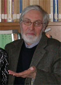
Personal
 Laurea in Geological Sciences from the University of Bologna.
Ph.D. in Structural Geology from the University of Ottawa.
Presently, Senior Research Scientist of the National Research Council at IEIIT-Bologna.
Personal
| Current Research
| National and International Activities
| Teaching Activity
| Publications
| Conference
 Laurea in Geological Sciences from the University of Bologna.
Ph.D. in Structural Geology from the University of Ottawa.
Presently, Senior Research Scientist of the National Research Council at IEIIT-Bologna.
It is long that investigators worldwide have attempted to forecast landslide occurrence by applying a variety of methods, namely: empirical, heuristic, statistical, "physically-based" and others. Owing to the global recession, today industrialised societies are not eager to invest a great deal of money to reduce natural risks by means of structural measures. Hence, the new issue is the development of predictive tools and warning systems aimed at both forecasting hazard/risk and minimising the loss of lives without investing in long-term projects of ground stabilization. Furthermore, the diffusion of GIS technology has greatly facilitated the application of quantitative techniques in earth sciences investigations. All of this has renewed the interest on landslide hazard assessment and mapping. Despite the technological advancements, many published landslide hazard maps still appear founded on ill-reliable input data and questionable or inconsistent techniques for model building. Young investigators should be aware of both the complexity and intrinsic limitations of all landslide hazards models. Many landslides are the result of the interplay of complex or unknown factors. Several relevant factors cannot be cost-effectively acquired over wide regions. It is very difficult to incorporate the time dimension in a hazard model. The most sophisticated data manipulation techniques will never compensate the adverse effects related to the use of incomplete or unreliable data. The development of a robust model requires both relevant (and costly) input data (geo-environmental factors, inventory maps, etc.) and a skillful design for data analysis and model development. Two decades of investigations on the application of GIS-based, multivariate statistical (black-box) models of landslide occurrence over pilot and very large areas in the Apennines and the Italian Alps have proved that this appraisal, when correctly implemented, constitutes a powerful tool for landslide hazard assessment and mitigation. During the seminar, the results obtained from the recent implementation of models for predicting debris-flows, deep-seated landslides, alluvial fans and rockfalls in Val di Fassa (Trento, Italy) will be illustrated and critically evaluated. In particular, the discussion will focus on the issue of producing a multi-process hard map that would be a really feasible tool aiding local administrators in the phase of land-use planning and hazard mitigation.