Part 1 : Risk management process and land-planning
Over recent decades, most countries have experienced an expansion of their urban areas. The complexity of the technological and human systems have also increased sharply. This concentration and complexity has thus largely contributed to the increase of the global risks to societies, albeit occasional individual risks may have decreased thanks to the progress of science and technology. Despite the development of risk prevention, social structures seem paradoxically less prepared to face disasters and alleviate their effects. It is noted that the approaches developed have not managed to successfully reduce the impact of the natural hazards so a better knowledge of the phenomenon is required to mitigate increasing losses. This is due to the fact that risk management has remained for too long concentrated on the strict analysis of the physical processes and favours technical solutions and structural measures rather than more qualitative and more global solutions. It too often focuses on the short term and on the management of the crisis and dismisses local know-how. From now on, risk management policies should adopt an integrated approach, involving all the stakeholders, from global to local, on the basis of a full diagnosis of the area, far beyond the problems of natural risks alone. This should take account of an analysis of the political aspirations for development, and be achieved through sharing research and good practice which is communicated efficiently between practitioners. The general process of landslide risk management will be presented, and then illustrated by part 2.
Part 2 : Global rockfalls risk management process in Désirade Island (French West Indies)
The Island of Désirade is severely affected by rockfalls. One house located in the place of "Le Souffleur" was partly destroyed by blocks in 1994, with two people injured. About 50 people still live under a dangerous cliff along the road from Beauséjour to Baie-Mahault, the two main villages of this Caribbean part of Guadeloupe. The first solution proposed by the State based on relocation of few houses was faced to population hostility. Solutions had to be reshaped and designed based on a global assessment of the different hazards affecting the Island (earthquakes, cyclones, flooding), on protection works taking into account the fact that French regulation prohibits new constructions behind protection fences, and on global and local land-use development. Risk management process has included technical analysis, social behaviour, cultural heritage of building and development, responsibility and regulation, short-term and long-term financing, land-use development strategy as well as information and communication. The solutions that are now being implemented seem to give satisfaction to all the negotiating partners. As carried-out by the multidisciplinary team the risk management process will be implemented as a training case, taking into account the data and parameters that are available through a specific GIS developed by members of the team. The place and the weight of landslide hazard in the decision process will be discussed.
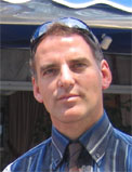
 E. Leroi is now director of his own company dedicated to land-planning and natural risk analysis. From 1991 to 2002 he was the head of the the geological natural risks department of natural hazard in Bureau d'Etudes Gélogiques et Minières (BRGM - French geological survey). He is now involved in one of the leading group in landslides assessment - the Joint Technical Committee 1 on landslides - on behalf of the three Sisters Societies ISRM, IAEG and ISSMGE. Recently he has been the authors of a multidisciplinary risk analysis in la Désirade Island (Guadeloupe France).